Pilot was great and provided excellent video and aerial photography for the property.
Charles Mazzini
Acquisition Manager
Trustland Group LLC
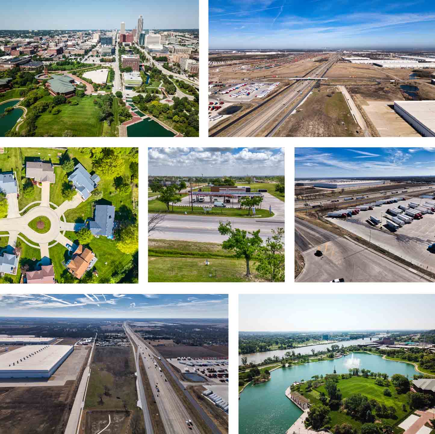
Drone photography helps properties stand out by capturing clean aerial perspectives that traditional photography cannot achieve. Precision 3D DFW provides drone photography services for residential and commercial properties throughout the Dallas–Fort Worth area. Our experienced drone
photographers capture high-resolution aerial images that showcase property layouts, architecture, landscaping, lot size, and surrounding areas from above. Whether you are marketing a luxury home, commercial building, acreage, or new development, aerial drone photography helps listings appear more visually engaging online. Drone photography services are commonly used for MLS listings, websites, social media, and digital marketing because aerial property images consistently attract more buyer attention. Precision 3D DFW delivers high-quality drone photography designed to help properties create a stronger first impression in competitive
markets.
Why Clients Choose Precision 3D DFW For Drone Photography

Improve safety, reduce access risks, get updates on timelines and benchmarks and capture detailed visual data for rooftops, towers, equipment, structures, and other hard-to-reach areas.

Create more engaging content that captures attention, strengthen branding, and helps properties and businesses stand out in competitive markets.

Gain better property and site insights, improve planning accuracy, and document land and project conditions with detailed aerial perspectives and spatial data collection.
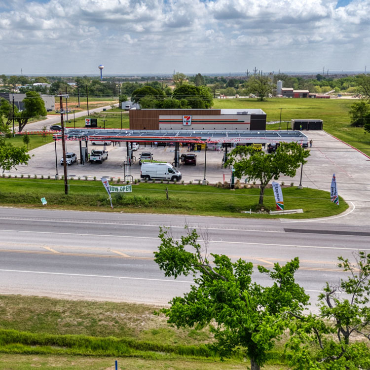
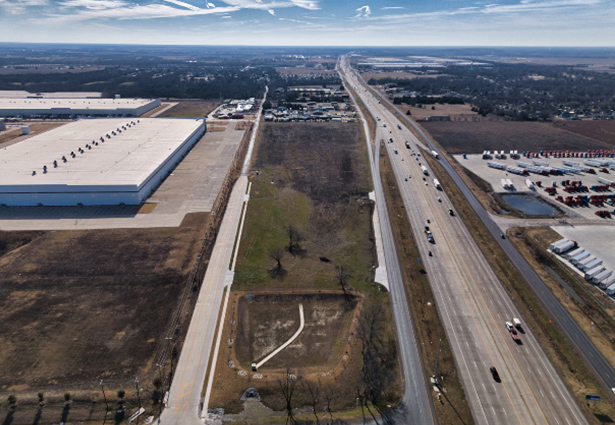
A drone photography session typically includes a variety of aerial angles designed to showcase the property and surrounding area from multiple perspectives. Common shots include overhead property views, front elevation angles, approach shots, neighborhood perspectives, lot boundary visuals, and wide aerial images that capture nearby features and surroundings. For residential properties, drone photographers often focus on landscaping, outdoor living spaces, pools, driveways, and overall property layout. Commercial drone photography may include parking areas, road access, nearby businesses, loading zones, and full-building exterior coverage from above. The exact aerial shots captured will depend on the property size, location, and marketing goals for the listing or project. A well-planned drone photography session helps create a complete visual presentation that highlights the strongest features of the property.
Before a drone photography shoot, it is helpful to make sure the property exterior is clean, organized, and ready for aerial visibility from above. Vehicles, trash bins, construction materials, and other distractions should be removed from driveways and outdoor areas whenever possible. Since drone photography captures the entire property layout, outdoor spaces such as pools, landscaping, patios, and parking areas should also be prepared before filming begins. Weather and lighting conditions play a major role in aerial photography quality, which is why shoots are typically scheduled during optimal daylight conditions. Property owners and realtors may also want to coordinate with tenants, contractors, or landscaping crews before the scheduled shoot time. Proper preparation helps create cleaner aerial images and stronger final marketing content.
The length of a drone photography session depends on the size of the property, the number of aerial images needed, and the overall complexity of the shoot location. Smaller residential properties can often be photographed within a short timeframe, while larger commercial properties, apartment communities, acreage, and development sites may require additional flight time and planning. Weather conditions, lighting, surrounding obstacles, and airspace restrictions can also affect the duration of the drone photography session. Professional drone photographers typically plan flight paths ahead of time to maximize efficiency while still capturing a wide variety of aerial perspectives. During the session, multiple angles and elevations are photographed to provide complete property coverage for marketing use. Efficient scheduling and organized flight planning help ensure the property is captured safely and professionally without unnecessary delays.
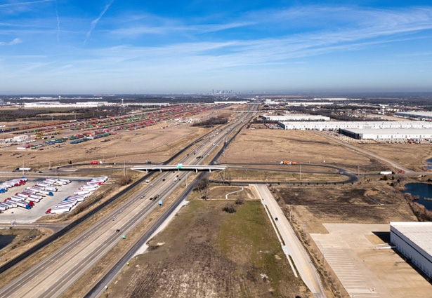
Yes, drone photography is commonly used to capture property boundaries, acreage, surrounding land, and nearby features that may not be fully visible from ground-level photography. Aerial images can help showcase lot size, tree lines, road access, neighboring properties, open land, and outdoor amenities from a much wider perspective. This is especially valuable for ranches, luxury estates, commercial properties, development sites, and large residential lots where buyers want a better understanding of the surrounding space. Drone photographers can capture multiple elevations and overview angles to help visually present the scale and layout of the property. These aerial perspectives are often used in property listings, land marketing, development presentations, and commercial real estate advertising. Clear aerial property visuals help create a more informative and visually engaging marketing presentation.
After the drone photography session is completed, all aerial images are organized, reviewed, and prepared for digital delivery. Clients receive high-resolution drone photographs that are ready for use across MLS listings, websites, social media platforms, brochures, presentations, and marketing campaigns. Depending on the project, the final image gallery may include overhead property shots, exterior perspectives, neighborhood views, and wide aerial overview images. Files are delivered in organized digital formats that make it easy for realtors, developers, and property owners to quickly access and distribute their aerial content. Fast turnaround times are especially important for active real estate listings and marketing deadlines. The goal is to provide clean, professional drone photography that is easy to use across multiple platforms and marketing materials.
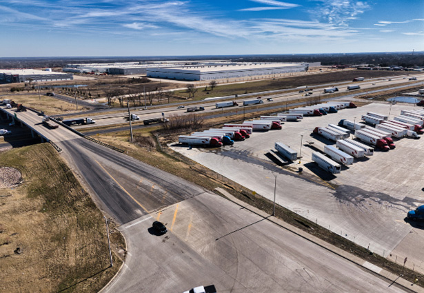
Drone photography services are widely used for residential homes, luxury properties, commercial buildings, apartment complexes, retail centers, industrial facilities, ranches, acreage, and development projects. Properties with large lots, outdoor amenities, unique architecture, or surrounding land often benefit the most from aerial photography because drones can capture perspectives that traditional cameras cannot achieve. Commercial real estate listings also use drone photography to showcase parking areas, road access, neighboring businesses, and overall property layout from above. Residential listings frequently benefit from aerial images that highlight landscaping, pools, outdoor entertainment spaces, and neighborhood positioning. Drone photography is also valuable for construction progress documentation, land marketing, and investment property presentations. Aerial property imagery helps create stronger visual marketing content for a wide range of property types.
Pilot was great and provided excellent video and aerial photography for the property.
Charles Mazzini
Acquisition Manager
Trustland Group LLC
Pilot was great, very detailed and provide exactly the right images, he confirmed everything in advance and delivered everything very quickly in multiple high quality formats, will use again for sure!
Matt Scow
Executive Vice President
SecureNetLease.com
An absolute pleasure to work with! Delivers high quality results and has great attention to detail. We’ll definitely be working with him on many projects to come!
Benjamin Martinez
Chief Pilot
Vimana Aerial Solutions